 The American Practical Navigator (Pub 9) is a publication, which describes the modern principles of marine navigation and includes the formulas, tables, data and instructions required by navigators to perform the computations associated with dead reckoning, piloting, and celestial navigation. The publication also contains sections addressing the Practice of Navigation, Navigational Safety, Oceanography, Weather, and Electronic Navigation.
Navigation Rules and Regulations Handbook – (File size 2.13 MB)
The U.S. C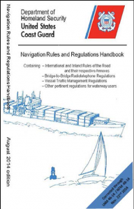 oast Guard publishes Navigation Rules for international and inland waters.
This publication, officially known as Navigation Rules and Regulations Handbook, contains the Inland Navigation Rules enacted in December 1980 and effective on all inland waters of the United States including the Great Lakes, as well as the International Regulations for the Prevention of Collisions at Sea, enacted in 1972 (1972 COLREGS). Mariners should ensure that they have the updated issue.
Chart No. 1 – (File size 17.90 MB)

Chart No. 1, Chart Symbols and Abbreviations Chart No. 1 is not actually a chart but a book containing a key to chart symbols. Most countries which produce charts also produce such a list. The U.S. Chart No. 1 contains a listing of chart symbols in four categories:
Chart symbols used by the National Ocean Service
- Chart symbols used by NIMA
- Chart symbols recommended by the International Hydrographic Organization
- Chart symbols used on foreign charts reproduced by NIMA
Subjects covered include general features of charts, topography, hydrography, and aids to navigation. There is also a complete index of abbreviations and an explanation of the IALA buoyage system.
NIMA International Code of Signals (Pub. 102) – (File size 895.09 KB)
 This book lists the signals to be employed by vessels at sea to communicate a variety of information relating to safety, distress, medical, and operational information. This publication became effective in 1969.
According to this code, each signal has a unique and complete meaning. The signals can be transmitted via Morse code light and sound, flag, radio telegraph and telephone, and semaphore. Since these methods of signaling are internationally recognized, differences in language between sender and receiver are immaterial; the message will be understood when decoded in the language of the receiver, regardless of the language of the sender.
The Notice to Mariners corrects Pub.
The Nautical Almanac (1981) – (File size 58.38 MB)
 For celestial sight reduction, the navigator needs an almanac for ephemeris data. The Nautical Almanac, produced jointly by H.M. Nautical Almanac Office and the U.S. Naval Observatory, is the most common almanac used for celestial navigation. It also contains information on sunrise, sunset, moonrise, and moonset, as well as compact sight reduction tables. The Nautical Almanac is published annually.
Current Tables (Reprint from the 1983 Tide and Tidal Currents) – File size 10.7 MB)
Coast Tidal Current Tables informs the reader on the expected behaviors of the oceans along the eastern coasts of North and South America, as well as the western coasts of Europe and Africa, and its waves through charts, graphs, and informative writing.
Topics include daily predicted times of slack water and predicted times and velocities of maximum current (flood and ebb), the speed of a current at times between slack water and maximum current, and the duration of weak current near the time of slack water. This book is published as one part in a set of four volumes listed below:
Tidal Current Tables: Atlantic Coast of North America
Tidal Current Tables: Pacific Coast of North America
Tide & Tidal Current Tables: New York Harbor to Chesapeake Bay
Tide Tables: Central & Western Pacific Ocean
Tide Tables
Central and Western Pacific and Indian Ocean Tide Tables contains full daily predictions for 76 reference ports and differences and other constants for about 2,600 stations in North America, South America, and Greenland.
It also contains a table for obtaining the approximate height of the tide at any time, a table of local mean time of sunrise and sunset for every 5th day of the year for different latitudes, a table for the reduction of local mean time to standard time, a table of moonrise and moonset for 8 places, a table of the Greenwich mean time of the Moons phases, apogee, perigee, greatest north and south and zero declination, and the time of the solar equinoxes and solstices, and a glossary of terms.
This book is published as one part in a set of four volumes as listed below:
Tide Tables: East Coast of North and South America
Tide Tables: Europe and West Coasts of Africa
Tide Tables: West Coast of North and South America
HANDBOOK OF MAGNETIC COMPASS ADJUSTMENT – File size 1.35 MB)
This document has been prepared in order to present all pertinent information regarding the practical procedures of magnetic compass adjustment in one text. As such, it treats of the basic principles of compass deviations and their correction, and not of the details of particular compass equipment
Distances Between United States Ports – – File size 1.13 MB)
Distances Between United States Ports contains distances from a port of the United States to other ports in the United States, and from a port in the Great Lakes in the United States to Canadian Ports in the Great Lakes and St Lawrence River. These distances are measured along navigable tracklines.
DISTANCES BETWEEN PORTS, PUB. 151 (World Ports) – – File size 1.87 MB)
The 2001 Edition of Pub. 151, Distances Between Ports, supersedes all previous editions. Distances in this table are in nautical miles based on the International Nautical Mile of approximately 6,076.1 feet. Nautical miles may be converted to statute miles of 5,280 feet by multiplying by 1.15.


 Light List for lights in U.S. territorial waters;

